
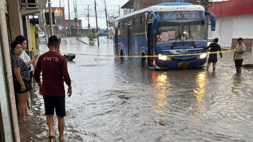
Azuay is among the provinces hit as the country enters the phenomenon’s initial development phase.
Ecuador’s rainy-season problems are arriving months earlier than normal, and the latest national figures show that the developing El Niño is already producing consequences well beyond isolated flooding. By October 25th, the National Secretariat for Risk Management had recorded hundreds of rain-related emergencies since the nationwide red alert was declared at the end of August, with more than 30,000 people affected and three deaths reported.
The most recent national tally put the number of adverse events at 629, including floods, landslides and other incidents linked to unusually heavy precipitation. Azuay is among the provinces listed by Risk Management as having significant impacts on the population, alongside Esmeraldas, Guayas, Los Ríos, El Oro, Manabí, Bolívar and Santo Domingo de los Tsáchilas. For Cuenca residents, the immediate danger has often been less about urban flooding than about the mountain roads that connect the city with the Coast.
Those problems were visible throughout the week. Heavy rain forced repeated clearing work and traffic controls on routes connecting Azuay with El Oro and Guayas. The Cuenca–Girón–Pasaje corridor experienced restrictions and landslide concerns, while western Azuay remained under particular scrutiny because of the combination of steep terrain, saturated ground and stronger rainfall forecasts. Drivers using those roads should expect conditions to change quickly and should check official road reports before setting out.
Why this matters in Cuenca
El Niño is often discussed in Ecuador as if its effects are the same everywhere, but they are not. Coastal cities can face intense urban flooding, while Cuenca and the higher Andes may experience a different mix of problems: landslides, blocked highways, river changes, strong winds and localized infrastructure damage. Western Azuay, including areas toward Molleturo and Camilo Ponce Enríquez, is especially vulnerable because the terrain drops sharply toward the Coast.
At the national level, the October 22nd bulletin from the official ERFEN monitoring committee said El Niño remained in its initial development phase. That is important because the most severe consequences may still be ahead. The current damage therefore should not be read as the peak of the event. It is better understood as evidence that the atmosphere and ocean are already producing unusual rainfall patterns before the traditional peak of the wet season.
Guayaquil offered the clearest example this week. Rainfall during one overnight period was reported at levels vastly above what is normal for October, flooding streets and disrupting traffic in parts of the city. The contrast with Cuenca is useful: a storm does not need to inundate the historic center to create problems for Cuencanos if it damages the roads they use to reach Guayaquil, Machala or the coast.
What residents should watch
The practical issue now is persistence. Continued rain increases the chance that slopes weakened by earlier storms will fail later, sometimes after the heaviest precipitation has already passed. Travelers should pay particular attention to Ministry of Infrastructure and local emergency-management notices, especially on mountain routes. Property owners in rural areas should also watch drainage, retaining walls and stream channels rather than assuming a relatively dry day means the risk has passed.
Risk Management’s running national reports are being updated frequently, and the ERFEN committee continues to monitor the evolution of the Pacific. The combination of a red alert, more than 30,000 people already affected and an El Niño that is still described as being in its initial development phase makes this one of the most important practical stories for residents heading into November.
0 Comments