Drones will be used to update Cuenca’s maps
Published on March 25, 2019

Facebook Twitter Google+ LinkedIn The municipality has acquired 5 drones that will be used for air photography of the city. The two main objectives will be to create and update historical photography records that the municipality has, as well as for planning a better expansion of the city. “Once the information from these devices has […]
More from this issue
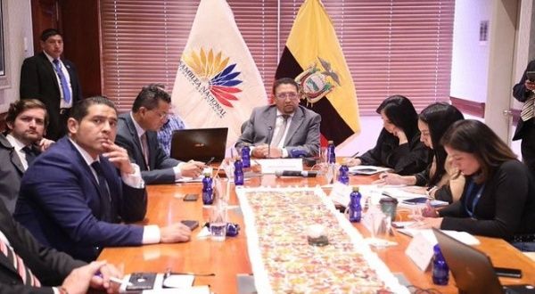
As the start the third week of the impeachment process initiated by the National Assembly begins, discussions about disregarding the Constitutional Court’s decision cast doubt on the entire process. After the Constitutional Court deemed the impeachment process against President Guillermo Lasso admissible, the National Assembly regained control of the process. However, as the process has […]
Prison Dialogue Commission says peace between 4 gangs is in the works
Commissioner Claudia Garzón was appointed as spokesperson to mediate a peace agreement with criminal organizations. The Prison Dialogue and Pacification Commission, formed by the President Lasso on December 16, 2021, announced that four criminal organizations that operate in the country’s prisons are willing to start a peace process. These gangs are Los Tiguerones, Lobos, Chone […] To view this article you must have an active subscription. Already a member? Sign in. Subscribe to weekly reports on Ecuador’s economics, politics, crime and more. Not sure you want to commit? Don’t worry, you can cancel anytime. For a limited time,subscribe now and get your first month for only $1. Regular subscriptions available at $4.99/month or $42/year. Subscribe now!
Lasso’s partial veto of the rape abortion law will go to the Constitutional Court
Assembly members and constitutional experts have divided opinions on whether the Legislature has the power to refer the veto to the Court. The plenary session of the National Assembly decided to send to the Constitutional Court President Guillermo Lasso’s partial veto of the law of interruption of pregnancy in cases of rape. However, constitutional experts are divided on whether […] To view this article you must have an active subscription. Already a member? Sign in. Subscribe to weekly reports on Ecuador’s economics, politics, crime and more. Not sure you want to commit? Don’t worry, you can cancel anytime. For a limited time,subscribe now and get your first month for only $1. Regular subscriptions available at $4.99/month or $42/year. Subscribe now!
Holidays in Ecuador during 2020
The Ministry of Tourism of Ecuador has published the holiday calendar for the year 2020. This definition of “holidays” is based on the Law of Holidays in Ecuador, approved in 2016, that defines in advance, holidays at the country level. Among those are the National holidays such as May 24th (Battle of Pichincha), October 9th […] To view this article you must have an active subscription. Already a member? Sign in. Subscribe to weekly reports on Ecuador’s economics, politics, crime and more. Not sure you want to commit? Don’t worry, you can cancel anytime. For a limited time,subscribe now and get your first month for only $1. Regular subscriptions available at $4.99/month or $42/year. Subscribe now!
Female scientists and academics battle gender stereotypes throughout Ecuador
Gabriela Vázquez is one of the few scientists in the city. She is in charge of the water laboratory of the University of Cuenca, and among her aspirations is that more women occupy technical positions and break the gender stereotypes in the academic, scientific and professional worlds. To support Gabriela’s belief, a study conducted by […] To view this article you must have an active subscription. Already a member? Sign in. Subscribe to weekly reports on Ecuador’s economics, politics, crime and more. Not sure you want to commit? Don’t worry, you can cancel anytime. For a limited time,subscribe now and get your first month for only $1. Regular subscriptions available at $4.99/month or $42/year. Subscribe now!
Contamination by illegal mining leaves legal actions and pollution in its wake
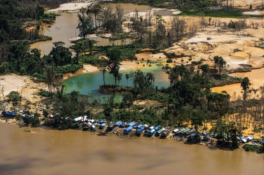
Pollution of rivers by cyanide, mercury and arsenic, as well as multimillion-dollar lawsuits for tax fraud and money laundering, are the effects left behind by illegal mining activity in the south of the country. According to the Internal Revenue Service (SRI) and the Economic Financial Analysis Unit (UAFE)—in charge of investigating possible cases of money […] To view this article you must have an active subscription. Already a member? Sign in. Subscribe to weekly reports on Ecuador’s economics, politics, crime and more. Not sure you want to commit? Don’t worry, you can cancel anytime. For a limited time,subscribe now and get your first month for only $1. Regular subscriptions available at $4.99/month or $42/year. Subscribe now!
79% of women in Azuay were violated at least once in their life
Azuay province records the highest number of cases in Ecuador of violence against women in any field: psychological, physical, sexual and heritage, both throughout her life and in her last year. This comes from the National Survey on Family Relations and Gender Violence Against Women, whose figures show that 79.2 percent of Azuayan women over […] To view this article you must have an active subscription. Already a member? Sign in. Subscribe to weekly reports on Ecuador’s economics, politics, crime and more. Not sure you want to commit? Don’t worry, you can cancel anytime. For a limited time,subscribe now and get your first month for only $1. Regular subscriptions available at $4.99/month or $42/year. Subscribe now!
Obesity in school children continues to increase in Ecuador
Every day, in fast food places, people are tempted with a “do you want to super-size your order? Maybe more fires or soda?” And many impulsively say “Yes.” But these types of products are on the ‘red list,’ as they have been shown to be part of an obesity epidemic, which affect more than 30% […] To view this article you must have an active subscription. Already a member? Sign in. Subscribe to weekly reports on Ecuador’s economics, politics, crime and more. Not sure you want to commit? Don’t worry, you can cancel anytime. For a limited time,subscribe now and get your first month for only $1. Regular subscriptions available at $4.99/month or $42/year. Subscribe now!
Municipality collects 14% of 2020 taxes in the first week
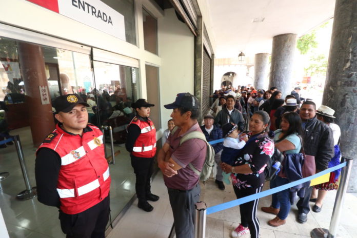
In the first week of collection of taxes for urban and rustic properties, the Municipality has brought in 14% of the projected fees for 2020, says Patricio Abad, the financial director of the local government. According to the latest property tax collection report, citizen payments totaled $1,750,000 in the first week; this amount is expected […] To view this article you must have an active subscription. Already a member? Sign in. Subscribe to weekly reports on Ecuador’s economics, politics, crime and more. Not sure you want to commit? Don’t worry, you can cancel anytime. For a limited time,subscribe now and get your first month for only $1. Regular subscriptions available at $4.99/month or $42/year. Subscribe now!
IESS bank offers new mortgage loan program
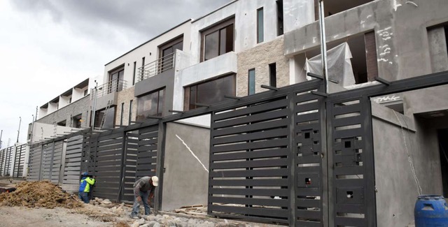
The IESS bank, or BIESS, has a new mortgage program for both new and resale homes. The new loans have lower interest rates and offer higher credit caps. And perhaps even more importantly, the program is also open to retirees and other pensioners. The preferential interest rates start at 5.99%, and the bank will finance […] To view this article you must have an active subscription. Already a member? Sign in. Subscribe to weekly reports on Ecuador’s economics, politics, crime and more. Not sure you want to commit? Don’t worry, you can cancel anytime. For a limited time,subscribe now and get your first month for only $1. Regular subscriptions available at $4.99/month or $42/year. Subscribe now!







0 Comments